
DTECT
Sensing the invisible.
DTECT is building a distributed passive radar layer that detects aerial objects using existing terrestrial broadcast signals — without transmitting radar energy of its own.
DTECT
DTECT is building a distributed passive radar layer that detects aerial objects using existing terrestrial broadcast signals — without transmitting radar energy of its own.
In 2025, unauthorised drones disrupted flight operations at 25 German commercial airports across 116 incidents. Direct losses to aviation came to around €60 million, rising to €160 million once knock-on effects across the network are counted.
Reads the drone’s control link, telemetry and Remote ID. A drone flying a pre-programmed route with its transmitter off emits nothing to read.
Effective, but it transmits. Spectrum licensing, siting constraints and cost put it beyond most civilian sites — and well beyond the density a large perimeter needs.
Useful for identification once you know where to look. Limited by weather, light and line of sight, and hard to scale across a perimeter.
Oct 2025
Repeated drone sightings closed the airport on consecutive evenings, affecting thousands of passengers.
Sep 2025
Large drones over the airfield suspended all traffic for several hours, with around fifteen flights diverted.
Large hubs absorb most of the diversions. Regional airports, ports and energy sites have less capacity to absorb a closure and less reason to expect a national-scale radar installation — which is where the gap is widest.
Sources: German Aerospace Center (DLR) analysis of Federal Aviation Office data, 2026; contemporaneous reporting on the incidents cited.
Terrestrial television transmitters already flood the sky with high-power signal, maintained continuously as national infrastructure. DTECT detects the reflections of those signals from objects moving through the coverage area.
DTECT only listens. There is no radar signal to license, approve or site — which changes where and how densely detection can be deployed.
The system is being built as a network of nodes rather than a single large installation, so coverage can follow the shape of a site.
DTECT is a complementary sensing layer alongside existing radar, RF and optical surveillance. Designed for open integration, including interfaces compatible with standards such as ASTERIX and SAPIENT.
Proof
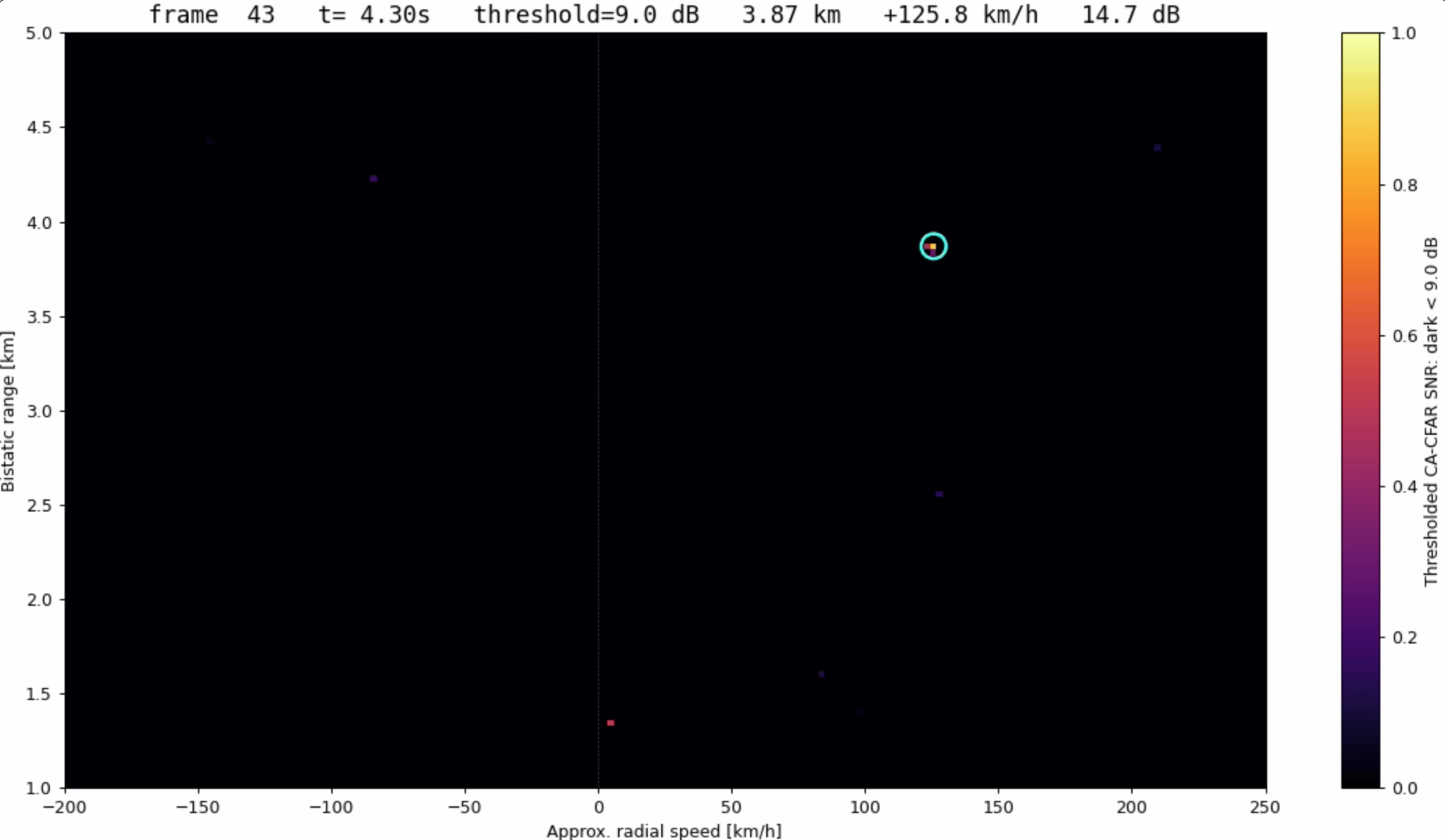
A single prototype DTECT receiver has detected and tracked a moving helicopter in real time, using a terrestrial broadcast transmitter as its only illuminator.
Multi-node localisation, height estimation and automated classification are in development.
Contact
DTECT is running field validation with operators of civilian critical infrastructure. If you are responsible for airspace security at a site with a drone problem, we would like to hear about it.